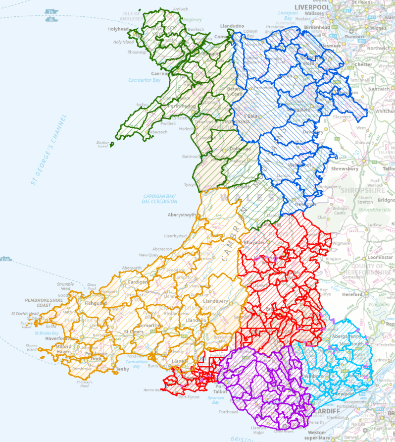
Following a reorganisation of the existing Church in Wales parish system into one of amalgamated Ministry Areas, Exegesis SDM Ltd have been commissioned to provide accurate, contiguous digital mapping of the boundaries for these new groupings. We had previously worked with Llandaff diocese to produce digital maps of the proposed Ministry Area boundaries, which were used in the consultation process. Now, all dioceses will have their Ministry Area boundaries mapped, along with church locations, church halls and rectories. This will provide a definite and consistent set of mapped data which will also be made available on the Church in Wales website
Further details of these services can be found on our GIS consultancy pages.
